Categories
Home Owners, The Real Estate MarketPublished January 13, 2020
HRM Interactive Maps

HRM Interactive Maps
The city of Halifax and the Provincial Government have provided some pretty fun interactive maps for all of us to enjoy. Check them out!
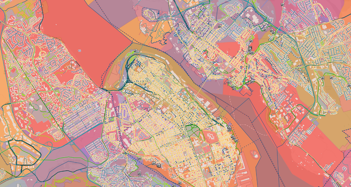
Explore HRM

ExploreHRM is an interactive web-map of the Halifax Regional Municipality that was developed to show the municipality's base geography, administrative boundaries, city facilities, and more. A tool to help people explore a variety information about Halifax Regional Municipality. You can find addresses, streets, bus stops, property information, Boat Facilities, Active Trailways, Land Use Areas, Polling Districts, Building Use, Tax Designations, Solid Waste Collection Areas and more!
This interactive web-map has been developed using Esri’s ArcGIS Online platform and is powered by Halifax’s Open Data.
Watch Out, this map is super interesting. Happy Exploring!
Launch the Explore HRM site here
Halifax Crime Map

Halifax Regional Police and the Halifax District RCMP provide you with contextual and timely information about crime in the areas where you live, work and play.
Launch the Crime Mapping app here.
Crime Mapping is an interactive site which is updated daily at 12:15 a.m. with incidents of five specific crime types:
robberies
assaults
break and enters
thefts of vehicles
thefts from vehicles
You can view the selected crime types one at a time, several at a time or altogether by three different time frames—yesterday, the past four days, and the past week. You can also search crime types by street name or community.
To ensure people’s privacy, crimes are plotted on the mid-point of the closest block and are not associated with any specific civic address.
Provincial Plowtracker

Plowtracker shows the winter maintenance activities taking place on provincially owned and maintained roadways. Users of Plowtracker should be aware that municipalities have separate winter maintenance programs, not reflected in this application.
Plowtracker offers simple, web browsing functions such as zoom and pan. In addition to showing you where our plows are operating during the winter season, Plowtracker also allows the user to turn on other information such as the provincial winter maintenance service levels, access to the provincial highway cameras, and the ability to see where winter maintenance activities have taken place within the last 30, 60, and 90 minutes.
Launch the Provincial PlowTracker Site Here
Happy Exploring!

Assist 2 Sell, HomeWorks Realty
| Assist 2 Sell HomeWorks Realty
or another way